Saturday, January 4, 2014

Year end update

Since I have not written a post after my August backpacking trip, I wanted to do an "end of year" update.  So here we go -

In September I was privileged to be able to attend a biology teachers workshop at Acadia National Park in Maine.  A group of 25 of us spent 3 full days exploring the park, learning about its natural resources and educational opportunities.  We hiked Gorham Mountain, went birding and visited tidepools with NPS naturalists, and made 2 excursions out onto the water.  It was a great experience.

Cross country season was a success.  My team finished in 2nd place at 3 championship races, and by my estimation was better than all but 2 of my other teams.  I have been coaching since 1996 so that's now quite a few years!   You can explore team results and photos here.  I am pictured here with my coaching staff at VanCortlandt Park in NYC, site of the 75th annual Jesuit Championhips.  I had run 14 miles from our hotel to the park that morning, so I was feeling pretty good!


Cross country sucks up huge amounts of time, so we did not have many other adventures to share from this fall.  We did get out for a nice hike on the AT on a beautiful fall weekend, a short jaunt to an overlook in VA called Bears Den.  This spot is about halfway between Harper's Ferry and the northern boundary of Shenandoah.   Views to the west take in much of the route of the Tuscarora Trail, including the section I hiked on my 40th birthday last year.  Just out of sight was the southern end of the rocky section I hiked earlier this summer.


Tatiana has been very busy working on her dissertation.  The girls continue to grow up very fast! Calista is in Kindergarten and loves it.  Linnea goes to day care most days and really enjoys that as well.  We did venture out to Wintergreen Resort for Thanksgiving, before driving to Cary, NC for the final race of the cross country season.  We hiked to Crabtree Falls, a scenic and icy cascade, and enjoyed a lovely feast at one of the resort restaurants for our Thanksgiving dinner. We also had a "family Thanksgiving" on an earlier weekend in November, in New Jersey after the Jesuit Championships.

Christmas has been the usual whirlwind of activity, with a trip to Grant and 3 separate trips to Hampstead.  Fun to spend time with extended family.  Some photos are here, including skiing behind my parent's house in Grant and Calista in the church Sunday School program.

Saturday, August 31, 2013

PCT summer 2013


This summer I hiked 170 miles of the Pacific Crest Trail in Southern Oregon with my brother Mike.  I am growing to really love hiking on this trail, with its mild weather, relatively easy grades (compared to the AT, anyway!), and beautiful scenery.  This summer I started hiking at Green Springs Summit, near the town of Ashland, Oregon.  Mike me up with my at highway 140 near Fish Lake, and we continued north together through the Sky Lakes Wilderness, Crater Lake National Park, past Mt. Thielson, and through the Diamond Peak Wilderness to arrive at Willamette Pass.  I have documented details of the hike in my Trail journal.  I have also created a Google Earth tour of the trip - which one can use with free Google Earth software to explore my trail journal from a geographic vantage. And here are the photos from the trip.  In addition, here are a few of my other hiking links: John Muir Trail (PCT 2009) | Northern CA PCT (2010) | Appalachian Trail (2004-2007) | My other trip journals | Mike’s journal for this trip.


I have now hiked 694 miles of the Pacific Crest Trail, which is just under 25% of the total mileage.  I don't know if I will end up hiking the entire trail, but I would like to at least do some additional substantial sections.  Just for fun, here's a list of the sections I have not hiked, listed in order of priority:

1. Heading north from Tuolomne Meadows, at least as far as Donner Pass.  This would cover the northern portion of the high Sierras

2. The northern ~750 miles, starting from where we left off this year in Willamette Pass.  I expect that if/when I do this section it will be broken down into three separate hikes, each of which would be around 250 miles and 2 weeks.  From Willamette to the Columbia River would be one logical segment.

3. At least one hike in the southern "desert" region of the trail, which covers 700 miles from the Mexico border to Kennedy Meadows, the beginning of the high Sierra.

4. At least one hike in the higher mountains of southern California, which span several distinct ranges near Los Angeles and are included in the 700 miles referred to in number 3.  The lower elevation portions I could hike during a spring break, while the higher elevation segments reach above 8000 feet and could see snow that early in the year.

Monday, July 22, 2013

Tuscarora Trail

I hiked a bit of the Tuscacora Trail recently with a friend.  I will call him "N" to protect the innocent . . or his reputation [ :) ].  The Tuscarora is an approximately 250 mile trail that connects to the Appalachian Trail on each end.  The southern terminus is near Overall Run falls in the northern district of Shenandoah National Park.  The northern terminus is near the Susquehanna River, just north of where the Appalachian Trail makes a major valley crossing of 15 miles or so.  Between those points it runs roughly parallel to the AT, along ridges several dozen miles to the west.  The trail was designed in the 1960s, during a time before the National Trails Act provided Federal oversight for protection of the AT corridor.  At the time, there was concern that urban development would encroach upon the AT to the extent that an intact corridor would not be preserved - and the Tuscarora was envisioned as an alternate route.


We planned a roughly 50 mile section, starting from the northern terminus.  N admitted to being in "less than ideal" shape, but we planned only moderately ambitious distances (mostly between 10 and 13 miles) along an elevation provide with minimal ups and downs with the exception of a 5-mile "roller coaster" section on day 3.  It appeared manageable.  From scouting ahead of time, I knew that water was scarce on the first ~20 miles of trail, so we cached some water near our intended campsite for the first night, left a car at the end point, and drove to the starting point of the hike.  We started at Millers Gap on the Darlington Trail, 1.5 miles further northeast along the ridge from the northern terminus of the TT.  The trailhead was a little obscure, but a friendly DNR officer happened by as we were putting the final touches on our packs and pointed us in the right direction.  The Darlington Trail was well maintained, and in little time we found the intersection with the AT.  As if to justify it's reputation as a "busy trail", I encountered three through-hikers just as I reached the intersection.  We took a lunch break at the nearby shelter, then continued on our way.  Turns out that the Tuscarora Trail is not nearly as well maintained as the Darlington (or the AT) in this area.  Japanese Stiltgrass and other plants covered the trail much of the time, often to depths of a couple of feet.  As we approached the first road crossing at route 34, the trail degenerated into a rutted stream channel, badly in need to re-contouring.  We walked for 1/2 a mile along route 34 and then followed logging roads for several easy miles.  Although this section was easy, we missed turns a couple of times - I topped out a steep climb of a power line cut without noticing a right turn 20 yards before the top, and N missed a left from one old woods road onto another.  The route became more rocky as the afternoon wore on.  At 7:00pm we crossed an old woods road that indicated we were 3 miles from where we had stashed our water.  With about 2 hours of daylight remaining, we figured we could get in before dark - but we were wrong.  The route alternated between long grass through poorly-marked ridgetop and extremely rocky sections.  Not as challenging as the climbs and descents of the White Mountains and western Maine, but probably the rockiest "flat" section of trail I have ever seen.  Around dark we reached the boundary of the Reinmman Audubon Sanctuary.  We continued for several hours through the darkness, proceeding by spotting one blaze with our headlamps before clamoring over rocks to the blaze, then finding the next one.  At midnight we finally reached the clearing at Waggoners Gap where we had stashed our water.  We had planned to hike another 0.8 miles to reach an official campsite, but given the conditions (it had also started raining, by the way), we set up in a picnic area and called it a day.

Given the late night, we slept until mid-morning.  It was still raining as we packed up, knowing that the next several miles were also reportedly rocky and rugged.  And indeed they were - it was mid-afternoon when we reached a landmark that indicated we had traveled a measly 4 miles.  After a couple of easy miles, we traversed another rocky ridge, and it was nightfall by the time we reached the Tuscarora State Forest boundary.  Though the plan had been to hike to the Wagon Wheel Shelter, we opted for a trailside campsite in Wildcat Hollow, where a stream lulled us to sleep.  Over dinner, we decided on a modified plan of action.  N was having trouble with the rocks, and seemed unlikely to be up for the 17.5 miles we would need to do the next day in order to make it to the car.  So we decided he would hike to nearby Colonel Denning State Park and spend the night there.  I would continued along our planned route, get the car the next day, and pick him up.

Day three dawned sunny and warm.  I climbed out of Wildcat Hollow to Flat Rock, where a broad view of the Cumberland Valley is accessible to anyone willing to hike 2.5 miles of relatively-steep trail from the state park.  I saw ~10 people in the section of trail near the view; other than them, we had seen only one hiker in the previous days and I saw no others after that.  There was a steep descent to the road near the state park, followed by a rather steep climb back to the ridge.  The next 8 miles were fairly easy, along an old road with scattered rocks and downed trees on top of the ridge, with little variation in elevation.  Next came the "roller coaster".  This segment featured 3 very steep climbs followed by some even steeper descents.  The route did not bother with switchbacks, and was so steep I feared I would tumble down the mountain in a few places.  The last descent also featured large (3-4 foot diameter) rocks in the middle of the steep trail.  At last I reached Fowlers Hollow, where a shelter awaited.  When I arrived at the shelter, I was puzzled at movement of a dark gray colored object in the corner - and discovered that a porcupine was inside the shelter, chewing on the wood.  I decided to set up camp at a nearby stream instead of using the shelter.  At least I arrived before dark.

On the final day, I started with one more crazy-steep climb, reaching the edge of the Hemlocks Natural Area on the top.  This area is part of the Tuscarora State Forest, and features some short trails; it's accessible via
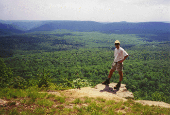
a dirt forest road.  From there I followed the ridge top for 10 miles, alternating between rocky ridges and old roads.  There was an excellent view (seen at right) at one of the high spots along the ridge.  The southern end of the ridge featured another crazy-steep descent, after which I reached the road where we had parked a car 3 days earlier, and where I had ended my 40 miles in one day last Sept.

Here are the rest of the photos.


Friday, June 21, 2013

Pocosin Cabin

After many years of talking about doing it, we finally rented one of the rustic cabins in Shenandoah National Park this week.  The Potomac Appalachian Trail Club, which we are members of, owns several dozen cabins spread throughout the Blue Ridge and into Pennsylvania.  Most are rustic in nature, with no electricity or modern plumbing; most also require walking a short distance from the nearest road.   For this trip, we settled on the Pocosin Cabin, a structure built in the 1930's and located near Swift Run Gap in Shenandoah.

Shenandoah has long been one of our favorite outdoor places - partly because it's perhaps the only natural area that we both learned to love before we met.  We have been there during nearly every season, from the bone-chilling cold of late March to the blazing colors of Autumn.  We have done family camping, explored history and park geology, and lots of hiking - the ~100 miles of AT through the park, as well as numerous other backpacking trips.  

The drive to the park was rainy and overcast, and for a few miles we could barely see a car-length ahead of us on Skyline Drive.  We stopped at the visitor center in Big Meadows in hopes of some clearing in the weather, and indeed as we arrived at the trailhead the rain slowed to a stop.  The hike to the cabin was only ~1/4 mile, and we needed two trips to bring in everything for two kids including a 1-year old.  The cabin is small inside, though there is space for 8 people to sleep - it would be tight.  We spent most of our time on the cozy front porch, which features a picnic table that is protected from the rain,  There was a view east to the valley near Stanardsville.  Our big adventure for the trip was a ~4.5 mile hike to South River Falls.  We could have visited this waterfall via a ~10 mile hike from the cabin, but that was a bit much to attempt.  So we drove a few miles down Skyline Drive to South Rive Picnic Area, where we have started/ended a couple of backpacking trips, and embarked on a a lovely hike past a tumbling mountain stream to the falls, 3rd-highest in the park.  I think we probably dropped (and gained) at least 1000 feet, and between the distance and the elevation it was definitely a record hike for Calista.  Linnea had a great time in the backpack and even fell asleep on the way down.  
Linnea had fun practicing her walking (she's getting close), including a stroll on the AT.  Calista loved the little spring near the cabin, and enjoyed meeting a thru-hiker at the spring one evening.  

On the way to the park the temperature dropped roughly 20 degrees.  We wore jackets and warm hats in the evening - always a lovely feeling during the summer!  All in all, a great little summer trip.  Here are the rest of the photos.

Monday, June 10, 2013

House remodeling

We have been pretty busy since winter with various house projects.  The major effort involved hiring a contractor to put in shelves next to our fireplace and re-finish the fireplace itself with stone.  The project also involved refinishing the floors, new light fixtures, and a few other items.  During this time we also removed the wallpaper from the dining room and then completely repainted the main area upstairs - the living and dining rooms.  So it looks very different now!  The room is not complete in terms of decor - we are borrowing a rug, buying a new chair, and trying out various pieces of artwork for the mantel and shelves - thus the current cluttered look.

We are also working on some other projects.  We are getting a new shed in the back yard.  I hired a local guy - the same one who helped build our shed at 50C Ridge - to demo the old, rusty metal shed and build a platform foundation for the new one.  The new shed will come from a company that will bring it in in pieces and assemble on-site.  We are also having new insulation and duct-sealing work done in the attic - not flashy, but hopefully it will reduce our heating bills next winter!

Below is a photo of the finished shed foundation.  Here are a few more photos, showing the old shed partially-removed and the house from the outside with the azaleas in bloom - from a few weeks ago.  I need to upload a "before" photo of the fireplace so that the contrast is more evident!

Wednesday, September 12, 2012

Milestone Hike

I had a milestone birthday this year, so I decided I would conquer a bunch of hills instead of just going "over" one, and put in 40 miles of hiking in one day at the same time.  Seemed like the appropriate number of miles!  I have done several long hikes before, but they were mostly supported, organized events: the 62-mile "One Day Hike" from Georgetown to Harpers Ferry on the C&O Canal (twice); the ~40 mile "Hike Across Maryland" on the Appalachian Trail, and the 35.5 mile "End to End" hike on the Brandywine Trail in Delaware and Pennsylvania.  But this hike would not be part of an organized event, and was supported only in the sense that my very accommodating wife offered to drop me off, meet me halfway, and pick me up at the end.

I chose to do a section of the Tuscarora Trail, which is a route that runs parallel to the Appalachian Trail through the mid-Atlantic region.  It was designed as an alternate route, back in the days (pre-1968) before the National Trails Act gave official protected status to the route of the AT.  Now the Tuscarora provides a scenic, low-crowds ridgetop route from Shenandoah to north of Harrisburg, PA.  The section I hiked for my birthday starts just north of the PA/MD state line, and ends near the town of Spring Run.  I started my day with a 3:30 wake-up call in Greenbelt. The original plan had been to drive out to Hancock and stay in a hotel, but when our bus returning from a cross country meet in Delaware was delayed, we decided to scrap that plan.  We arrived at the trailhead in time for a 6:00am start - before the sun rose at 6:45.  I climbed over 1000' feet of sometimes-steep trail in the dark, and was greeted by first light as I crested the ridge.  From there the route was mostly flat for the next 20 miles, according to the map.  However, as it turned out, "flat" did not mean "easy".  The first 12 miles of ridgetop hiking had seen little maintenance since spring, and was overgrown with several species of invasive plants, and at least two species bearing nasty prickers.  There were also several long stretches of rocky, ridgetop route that made for slow going (see the photo above right).  In many places the route was hard to follow, and although I knew I would not get lost because the trail stayed on a narrow ridge, it was still slow going for an agenda that involved hiking 3-4 miles per hour.  But I did not panic, and enjoyed the clear blue sky and dry air - the first such day in many weeks - probably since my last Tuscarora Hike in May, actually. 

Around mile 10 I encountered the first of three porcupines that cross my path that day.  It was following the trail, and made a clicking noise with it's teeth because it was nervous about how close I was.  Fortunately it found a sidetrail that headed to a shelter and I was able to pass by.  I also saw a large turkey, a deer, a rattlesnake, and I am fairly sure I saw a bobcat.  It bounded away quickly, and I could appreciate why people mistakenly claim to see cougars in the eastern woods on occasion. 

After crossing PA route 16 at the 14 mile mark, the route got much easier.  Vegetation had been cleared to the edge of the trail, and the route was well-marked.  I began to make better time.  Near the crossing of US 30 was a terrific view to the west, near a side used for launching hang-gliders.  A bit further north, dark clouds appeared and it rained for a few minutes - but the rain was light and did not last long.  Soon I came upon another terrific view, this one to the east and north (and pictured here).  After descending steeply to Cowans Gap, I found Tatiana and the girls at the state park, hanging out on a blanket in the grass.  Milepost 23.5, and it was already mid-afternoon.  I hung around for a little less than an hour, then got on the trail again.  Fortunately for me, much of the rest of the route - with the exception of three miles of narrow, rocky ridge, was along old woods roads which made for quick hiking.  A few miles later I passed an intersection where the Great Eastern Trail splits off.  This trail is a work-in-progress that is intended to be a continuous hiking trail from Tennessee to New York, by way of eastern Kentucky, West Virginia, and Pennsylvania.  There are several alternate routes though the mid-Atlantic, and one follows the Tuscarora for a bit.  Later I climbed to the rocky ridge where the trail crosses a mountain through which the Pennsylvania Turnpike passes in a tunnel.  I could hear the roar of truck traffic for several miles.  As I descended from this ridge, darkness was falling.  I hiked the last couple of miles along lightly-traveled paved roads in the gathering darkness.

Just for fun, here are some of my endurance "personal records", which I reflected on during this hike:

62 - most miles hiked in a day (C&O Canal, "One Day Hike")
28 - most miles hiked with a full backpack - on a day in Maine
27 - most miles run at one time (Boston and Marine Corps marathons - for the Marine Corp I jogged from the Pentagon metro to the start line because I was late - that was at least an extra 0.8)
75 - most miles biked in one stretch (I need to do a century sometime) 
18 - most miles cross-country skiing (not sure about this one - there was an all-day loop that we used to do at Susqhehannock Lodge that I think was 18).

I have now hiked almost 150 miles on the Tuscarora Trail, which represents 58% of the entire route.

What do I want to try next?  There are supported "endurance hike" events held on several other trails that I would consider.  I would really like to do a one-day traverse of the Presidential Range in New Hampshire.  

Here are the rest of my photos from the day.

Friday, June 1, 2012

Organization time!

It's been a while since I had a chance to post anything here.  There's been a lot going on - moving to our new house, getting ready to sell the old house, getting ready for the new baby!

But we have made some progress towards improvements in the new house.  We have done a lot of work in the yard.  Our back yard, in particular, in a case study in invasive plants - we have English ivy, Poison ivy, Multiflora rose, and a particularly pervasive species called Japanese Knotweed.  So far I am mostly using mechanical control, waging war against the invaders.  We want to eventually plant some of our favorite perennials and bushes, but most of that will need to wait until at least the fall.  I started taking photos tonight after the major rainstorms hit, so I don't have any photos of the yard to show off.

Instead, I have some photos of rooms that are in relatively good shape.  One of the rooms we are most excited about in this house is the mud room/laundry room.  It was already painted this bright red color, but we have added vertical bike storage (that was quite an operation, trying to figure out which sections of the wall would support the weight of the bikes!).  We are also happy to be using all of this extra storage space for tools and other stuff.

Here you can see my bike and the charging station for my electric lawnmower - another new acquisition, since at the old house I could mow in 5 minutes using a mechanical/non-motorized mower.
 We are also excited about being able to store all of our outdoor gear in a more accessible and temperature-controlled environment.  Everything was in the attic before.  I have converted a closet in the guest bedroom to a gear storage space (the rest of the bedroom is not finished yet, so no photos!)
 We have a large "common room" in the downstairs area.  Mostly it's a play space right now, but it has the potential to be multi-purpose.  Here is a corner with some organized space.
 I also have my desk and files pretty much in order.  Here's a couple of parting shots of that area.  Not exactly pretty - Tatiana has been talking about replacing the desk for years - but it's functional.  Tatiana has an office in one of the bedrooms, and it's functional but needs some work be to "done". 

We also painted all four of the bedrooms.  We have big plans for the main room upstairs, but we are not quite ready to execute yet.  Hopefully it will soon see some built-in bookshelves and other improvements!

Wednesday, February 29, 2012

Lament for a lost winter

It's been a rough winter for snow-lovers like me. There have been few opportunities to ski or play in the snow. In DC we had snow a couple of times, but never as much as even an inch, and it all melted almost immediately. When we visited Michigan at Christmas this year, we could not even find sufficient snow for skiing in Cadillac, normally a great place to ski. We cancelled our annual trip to Lake Placid because of weak snow conditions (they had some, but it was icy and the temperatures were forecast to be above freezing all weekend). We did get out to Canaan Valley for one of the few weekends with good conditions, so I was greateful for that.

In this spirit of wishing for a better snow season in 2013, I decided to compile a list of my favorite places for cross country skiing. Later I plan to do a post on places where I would like to ski, in the spririt of my "top 10 places where I would like to backpack" list.

So here's the list, in countdown format:

Runner-up status go to McKenzie ski trails in Michigan and Blackwater Falls State Park in West Virginia

10. Cadillac Pathway is a trail system just outside the city of Cadillac, less than 2 hours from where my parents live in Michigan. I have only skiied there a few times, but on our most recent visit we experienced excellent conditions, with fresh powder and great gliding through forested, moderately challenging trails.


9. New Germany State Park is in western Maryland, in the mountains of Garrett County. This region rises significantly from the east to nearly 3000 feet, and gets substantial winter snows. The state park has an nice compact system of trails, with some fun downhills and a very scenic stretch through hemlock forest, paralleling a creek. There is a small warming hut with rentals and light food during busy times as well. It's one of my favorite places for a quick trip when conditions are good.

8. Fahnestock State Park is in the Hudson Valley region of New York, only about an hour north of New York City. We have skiied here a couple of times on the way up to the Lake Placid area. They have a nice network of trails through woods, as well as some that go over a frozen lake. The area is highly scenic, and features a mountainous ridge along which the Appalachian Trail travels.
7. Susquehannock State Forest is in north-central Pennsylvania, in one of the least-populated regions of the eastern US. It is heavily-forested and mountainous. I have skied here multiple times with the Wilmington Trail Club. Our excursions usually featured skiing along the Susqhehannock Trail, a long-distance hiking trail that makes a ~80 mile loop through the forest. None of this area is groomed, so the skiing can be challenging if the snow is deep or icy. But in good conditions it's a great place to ski, with scenic and lightly-travelled trails. The image above right is from the Susquehannock Trail in 2007. Also nearby is the Pine Creek Gorge, which features a rail-trail through the bottom of a scenic canyon.

6. Lapland Lake cross country ski area is northwest of Albany, in the southern section of the Adirondacks. The is a groomed ski resort with many miles of fun trails, and an opportunity to ski fast. There are some steep hills that are quite ski-able because of the groomed conditions. Trails wind through hardwood and hemlock forest and along the edge of a large lake. Also nearby is backcountry skiing on the Northville-Lake Placid trail. We have skiied here numerous times with the Wilmington Trail Club.


5. Winona State Forest in upstate New York. This area is a lot like Big M, with a trail system through forested land on varied terrain, in an area with low population density. The trails are groomed by local volunteers. Winona lies in the Tug Hill Plateau snow belt, in the area north of Syracuse, between Lake Ontario and the Adirondacks. Thus it gets buried in snow every winter and conditions are usually quite good. I skiied there several times with groups from the Wilmington Trail Club in Delaware, though not recently. On one memorable ocassion, the snow was coming down so hard that our cars were stuck in the parking lot after we came back from skiing! This trail system does not benefit from any warming huts or day lodges, so trail lunches are brief to prevent freezing fingers!

4. Big M in Michigan. This area is part of the Manistee National Forest, north of my parents house, between Ludington and Cadillac. It's in the middle of nowhere and thus is rarely crowded - I don't think we have seen more than 10 cars in the parking lot. They have a warming hut with a wood stove, which is nice for breaks between loops. The trail system is scenic and has some moderately-challenging sections with some nice hills. Most trails run through secondary-growth woods with moderate-to large sized trees. Volunteers groom the trails when snow depth is sufficient. One of my best memories from Big M was a couple of years ago when several of us were skiing there as snow drifted down out of the ski and we glided through silent woods.

3. High Peaks/Adirondack Loj. The High Peaks region of the Adirondacks has been a magnet for both summer and winter backcountry travel for many years. When I was a student at RPI I spent making weekends hiking in these mountains. In recent years we have visited in the winter, and I have enjoyed exploring the mountains during winter conditions. The Adirondack Loj (so-named 100 years ago as a result of a "spelling reform" movement) is the base of operations for trips into the wilderness. The snow is deep and the scenery outstanding in most winters. We have skiied and snow-shoed in this area. The High Peaks would rank #1 on this list for scenic value. The photos at right is from one of the trails near the Loj in 2011.

2. Whitegrass is a ski resort in the Canaan Valley of West Virginia. This area features the unusual combination of groomed trails, backcountry loops, and serious hills in one compact area. There are miles of groomed trails ascending over 1000 feet from the valley floor to the top of Bald Knob and the nearby high plateau wilderness area known as Dolly Sods. It's great fun to ski through hemlocks and red spruce in the backcountry regions at the top of the hill, and to cruise down the return trails to the bottom, especially the gradual downhill trail called Powderline. We visit this area 1-2 times per winter, since it's relatively close by. Whitegrass is pictured here.

1. Mount Van Hoevenberg and the Jackrabbit Trail. The Lake Placid region is fantastic for skiing, and these two areas combine to form my top ski destination. Mount Van was the olympic ski venue in 1980, and continues to be managed withe a great network of groomed trails - some are easy routes that amble along creeks or through snowy woods, while others have challenging hills and curves. The groomed trail center is connected to several other skiing areas by way of the ~40 mile long Jackrabbit Trail. When we have stayed in the area in the past, we have been close to this trail, which crosses a combination of groomed and backcountry stretches on the way to Mount Van. It's a fantastic place to ski.


Well, that's it for my top-10 list. Later I will post a wish list of places where I would like to ski - with destinations in Vermont, New Hampshire, and various western National Parks topping the list.

Monday, January 16, 2012

Canaan Valley

We spent the weekend at Canaan Valley, West Virginia with some friends. I have written about some of our past trips before - it's an annual trip for us, sometimes multiple trips in a winter. This year the weather has been a bit unwelcoming for lovers of snow. The temperatures have been mild, and most precipitation has come as rain. This could be related to LaNina conditions being experienced in the equatorial Pacific this year. It's been particularly difficult for us - we drove to and from Michigan for Christmas through snow each way, but found little to no snow on the ground while we were there. No skiing at Christmas this year.

Things did not look much brighter as our planned weekend excursion approached last week. It was mild and wet out in West Virginia, with no snow base as late last last Thursday morning. Then a cold blast of air came through, along with roughly 6-8 inches of white stuff - just enough to cover the trails and create ski-able conditions at White Grass, where years of maintenance have cleared rocks and stick from the trails. We got some fresh powder overnight Friday and Saturday, which meant the conditions were surprisingly good for skiing all around the mountain this weekend. Of course we had a great time hanging out with everyone. Group dynamics have changed a bit over the past few years - though the participating families/couples have varied somewhat, we set a record with 5 kids in the house this time - and with three expecting couples, this same group will have 8 kids next winter!

As for plans for future ski outings, we will be somewhat limited for the next three weeks as Tatiana works towards her comprehensive exams. We do plan to return to Lake Placid for President's weekend.

Here are some photos from the weekend and also from Christmas.

Monday, October 31, 2011

A lousy day for a race

Last Saturday was the WCAC championship in cross country. My team competes in this event every season - and we have won the championship for the past three years. As the event approached last week, the weather forecast continued to worsen. A storm that dumped 16 inches of snow on the Front Range in Colorado was headed our way. On the morning of the race, the temperatures hovered in the upper 30s and a cold rain had been falling all night. The course, covering a mixture of grass and dirt trails, was in awful shape. Two features of the course were particularly problematic this year. The course features a crossing of a ~20 yard wide creek, which is normally ~6 inches deep at the most. Swollen with the rain, the water was turbid, obscuring the bottom, and reached several feet in depth. In addition, a downed tree forced a detour on another section of the course, resulting in a steep descent on what soon turned into a very muddy hill.

As the day continued, conditions worsened, such that by the time the varsity team toed the line, sleet was blowing in on a stiff wind, and the temperature had dropped to below 35. At the end of the race, several of my runners huddled in warm vehicles to recover from the extreme shock their bodies had received. In addition, a runner in the freshman race injured his toe on the creek crossing, and many athletes went home with muddy, soaked clothing.

These were the worst conditions I have seen in 16 years of coaching. Several of my assistant coaches, with an additional 40+ years of experience, agreed with this assessment. I have run in below-zero temperatures with snow on the ground (MIAA championships in college) and in many other instance in the rain and mud. The New Castle County Championships had to be postponed one year after the first couple of races because the course was too dangerous. The Prep Classic in 2009 faced a similar situation. But Saturday, Oct 29th will go down in my memory as the most brutal conditions to date.

Thursday, September 22, 2011

Glacier National Park!

Last winter, I saw a notice in a newsletter about a workshop being held for biology teachers in Glacier National Park. I thought it looked like a great opportunity, so I signed up to go, even though it would mean missing 3 days of school.

I had visited Glacier two times before. I was there with my family on a summer trip, when I was 14. Then, in 2001, I drove out to Montana during the summer and spent about a week in the park, including a 5-day backpacking trip.

The group for this trip included roughly 30 teachers and a few spouses. A few were retired, but most were currently teaching biology (and many also environmental science) at high schools. A few were teachers at community colleges. We were led by a retired teacher from Colorado who has been organizing trips to natural places for student and teacher groups for more than 30 years.

We had many great opportunities to learn about Glacier National Park as an educational resource, and about scientific research being done in the park. Sessions were led by enthusiastic park staff as well as USGS employees - who are based in the park and may as well be considered park employees too. The experiences included talks/discussions on the famous grizzly bear study in the park, which involves capturing hair samples for DNA analysis; studies of melting glaciers and other impacts of a changing climate; and fascinating research on wolverines. We also took a guided hike with a fire ecologist specialist who works for the park, and learned about the alpine zone and about regional geology with a park naturalist. We saw mountain goats and elk, but did not manage to catch site of any grizzlies or wolverines. We did see quite a bit of bear scat, including evidence that a black bear had become prey . . . perhaps for a grizzly.

It was a lot of fun to meet other teachers, to see the park from a new perspective, and to discover unexpected "small-world" connections. Many park facilities were closed for the season, and most others would close the day that we left. The weather was cool during the day and quite cold at night (and at Logan Pass, where wind chills were well below freezing), and some of the aspens were turning yellow. Peak fall colors won't hit DC for another 6 weeks, so that was quite a nice treat. I also met a ranger who had worked with my brother, and found out that the workshop leader had met one of my brother's friends when he worked as a seasonal naturalist many years ago. Any my roommate, a teacher from Indiana, vacations in northern Michigan and drives through my hometown of Grant on the way there.

I could go on, but I will stop there because anyone who has made it this far is probably not interested in any more details! Here are the rest of my pictures.

Sunday, September 11, 2011

Running in 50 states

I was talking to a friend from church yesterday, and he mentioned that he keeps track of how many states he has gone running in. Being the sort of person who likes to make lists, that got my attention. I decided to count how many states I have run in, and came up with 34. Not too bad! My brother Mike has a goal of backpacking in every state, so I have been keeping track of the states I backpack in as well - the count there is 21 (half of them on the A.T.).

I decided to also count how many states I have hiked and camped in. The result: hiking 43, camping 47. I have visited 49 states (missing Hawaii), so the only two have I visited but not camped in are Missouri and Rhode Island.

I have also been keeping track of the state high points I have visited for a while now. I have been to the high point in 18 states, and in another 8 states I have seen the high point (Mt. Rainier and Denali, for example).

Tuesday, September 6, 2011

National Parks update

For about 10 years now, I have been keeping track of my visitation statistics for National Parks and related sites - Monuments, Historic Parks, Recreation Areas, etc. The National Park Service manages over 390 sites now, and a few new ones are added to the system periodically. The latest addition came as part of a large public lands bill in spring 2009, adding various historic sites including a battlefield in Monroe, MI.

This summer, on our epic California-and-back trip, we visited 34 NPS sites, 6 of which were National Parks: Grand Canyon, Zion, Channel Islands, Redwood, Joshua Tree, and Death Valley. I have now visited 310 out of the 391 sites on the official list. These range from little-known historic sites such as the small historic house in rural MD owned by Thomas Stone, a signer of the Declaration of Independence, to large iconic parks like Yellowstone and Yosemite. Many sites my visits lasted only a few hours, but I have spent more than a week backpacking through some of the larger parks. Most of the sites I have yet to visit are in the extreme southwest, or in remote areas beyond the contiguous 48 states. Highest on my list of parks to visit would probably be Katmai in Alaska.

Calista has her own National Parks passport book, and each time we would enter a new park she and I would stamp the book together.

Monday, September 5, 2011

2011 PCT Trip: Seiad Valley to Green Spring Summit

This summer I hiked from Seiad Valley to Green Springs Summit on the PCT. As he had done last summer, my brother Mike joined me for the trip. We hiked northbound, although in this section that meant we were mostly going east. The PCT winds its way westward from the Sierras to travel through the Trinity Alps and Marble and Klamath Mountains. In this stretch, it returns east to the Cascades, which are longitudinally (is that a word?) in line with the Sierras. This hike was beautiful and wild, in spite of the fact that it covered little in the way of official wilderness and many stretches of trail ran parallel to dirt forest roads. I have now hiked approximately 477 miles on the PCT - 18% of the total trail.

Here is a link to my trip report.

Tuesday, August 16, 2011

Summer trip

We returned about a week ago from our epic, 6 week summer trip. This was the second year in a row that we were able to explore the country for a long stretch in the summer - what a blessing!

This year the primary motivation for heading to California was so that Tatiana could do some research - paint analysis, specifically - at the Getty Institute in LA. But since we had the time, we camped all the way out and back, and I backpacked for 5 days with Mike too.

The route this time was along the I-40 corridor - we had travelled along I-70 and 80 last year, so this was a chance to see some new things. We mostly focused on National Parks and other NPS sites (historic sites and monuments, mostly) in New Mexico and Arizona. We visited 35 NPS sites, including 6 national parks. I have been keeping track, and this brings my total NPS sites visited up to 310 - about 79% of the total. The sites I have not been to are primarily in the extreme southwest, the northwest, and outside the contiguous 48 states.

Calista has a national parks passport, and has been collecting stamps. She also earned numerous junior ranger badges in the various parks.

The backpacking trip was a highlight. We started at Seiad Valley, along the Klamath River, hiking north on the Pacific Crest Trail. We had started south from the same spot last year. This time we only had 5 days, but we covered roughly 80 miles, finished at Green Springs Summit, east of Ashland, Oregon. We encountered large piles of snow above 7000 feet along some of the ridges, making the hike quite a challenge. But there were few other hikers around and the views were outstanding, making it a memorable hike.

Other highlights included a weekend trip to Santa Cruz Island, part of Channel Islands National Park. We camped overnight and hiked along a bluff overlooking the ocean - the photo at the top of the post is from Santa Cruz. Staying at the North Rim of the Grand Canyon, exploring Zion National Park, and seeing two ancient volcanoes (Sunset Crater and Capulin) were also high points.

The other images in this post are of me and Calista at the top of Mt. Magazine - the highest point in Arkansas - and of Calista getting sworn in for her junior ranger badge at Fort Union National Historic Site.

Here is a link to my summer trip report, which has more details about what we did each day and where we camped. There are also links to lots of photos!!

Sunday, May 15, 2011

Top ten list . . . Eastern US backpacking trips

OK, time for list number 2. Most of my major dreams for backpacking trips involve the western US, now that I have hiked the entire AT. But there are a number of shorter trips in the Appalachians that I would like to do at some point as well. Many of these are weekend or 4-5 day affairs, or could be extended given the time.

I would actually consider hiking the entire AT at once sometime in the future. If I ever do it, I would probably start around the first of May and aim to finish by the end of August, maybe mid-September. This would prevent hiking in iffy weather and late snows in the south and would maximize appreciation of the rhododendrons in May-June. It would also allow me to finish before early wintery weather is likely in Maine. It would be a fairly ambitious pace - roughly 500 miles per month, 125 per week.

I have also included some favorite sections of the A.T. that I would like to repeat with friends or family as shorter trips. Once again, I am not ranking them in order.

1. Laurel Highlands Trail. This is a ~70 mile route through the Laurel Highlands region in southwestern PA. It's one of our favorite places - we were camping in Ohiopyle when we got engaged, and we have skied and hiked in the area a few other times. This route has regular shelters, and I envision it would be good for a first long trip for Calista . . so a few years down the road, and only if she takes to backpacking!

2. Repeat Presidential range on the AT. The ~30 miles of trail between Crawford Notch and Pinkham Notch in New Hampshire's White Mountains include over 15 continuous miles above treeline. It's one of the most spectacular and memorable sections of the 2175-mile trail. I am interested in hiking the Presidentials as an extreme day hike (one can start north of Madison Hut and make it around 25 miles, I think). For backpacking, given the time, I would add the next section south to Franconia Notch, which would include Mount Lincoln and Lafayette; and possibly the Carter-Wildcat range to the north as well. I have also been thinking about hiking part of all of this route from hut-to-hut, staying at the high-elevation enclosed primitive lodges that are maintained by the AMC. Accommodations are a bit pricey, but would make a memorable family trip.

3. Green Ridge State Forest/C&O loop (MD). This is a a~40-45 mile loop that could be done in 3 days and is close to home - the trailhead is less than 2 hours away. Half of the route is along a traditional hiking trail in MD state forest land, and the rest follows the C&O Canal towpath along the Potomac River through rugged and undeveloped mountain terrain. The canal route includes a trip through the Paw Paw tunnel.

4. Foothills Trail (SC). This route follows a route in the high-elevation portion of South Carolina, near the NC border. It's a good 5-7 day route (76 miles), and gets good reviews for waterfalls and solitude. The trail passes through Table Rock State Park, which is said to offer outstanding views.

5. section of the Mountains-to-Sea Trail (NC). This trail is a work-in-progress that will eventually span 1000 miles west-to-east in North Carolina, from Clingmans Dome in the Smokies to the ocean. I think it would be fun to do a week-long section on the mountainous western end of the trail.

6. Florida Trail through Ocala or Appalachicola. The Florida National Scenic Trail starts in Big Cypress National Preserve, just north of the Everglades, and winds it's way through forest remnants along the middle of the state, then turns west to trail the panhandle region. Including alternate and side routes there are around 1000 miles of trail in the system. Some hikers start in Big Cypress (or even in Key West, hiking initially along US route 1) and make their way through connecting routes in Alabama to the AT, then north to Maine. I am not that ambitious, but I would like to do the ~70 mile section in Ocala National Forest, which lies just north of Orlando. This segment has some wilderness character and would be a fun March (spring break) excursion. Another option would be to hike in Appalachacola National Forest, in the panhandle region.

7. Repeat Roan Mnt to I-81 (AT). One of my favorite sections of the AT included the areas around Roan Mountain, the Grayson Highlands, and the Smokies. Given enough time, I would hike from Fontana Dam through the Smokies, over Roan and Rogers again. A one-week trip could start (or end) at Roan Mnt and hike north to Mt. Rogers and beyond. A good end point would be the Settlers Museum, just a few miles from I-81.

8. Repeat Long Mnt. Wayside to Rockfish Gap (AT). We day-hiked this segment over a couple of days, and it included some beautiful views and grassy ridges. I would love to explore them again, especially in May-June or in the fall. A good opportunity for a long weekend or a 5-day trip.

9. Allegheny Trail (WV). This 330-mile trail runs north-south through West Virginia, starting near Pearisburg on the AT and ending north of Canaan Valley - one of our favorite places. It's much less-used than the AT or other eastern trails, and would provide good opportunity for solitude. At this point I am interested in any length trip along this trail, whether a weekend or a full week. A portion of this trail is part of the route for the Great Eastern Trail, a long-distance route that parallels the AT further west. It includes the Sheltowee Trace in Kentucky, the Cumberland Trail in Tennessee, the Pinhoti Trail in Alabama, and the Tuscarora Trail in VA/PA, and in total extends from Alabama to NY.

10. Northville-Lake Placid trail. This would be another good week-long excursion, running north-south through the Adirondacks. We have skied a portion of it in the south. There are shelters along the route. It would also be interesting to connect this route to the High Peaks region and summit one or two of the high peaks there at the end of the trip.

Also worth mentioning:

Tuscarora Trail - this ~250 mile trail was envisioned in the 1960's, before the National Trails System act provided federal protection for the AT corridor. Hikers were concerned that the AT route through northern VA and MD would become over-run with development, so they designed this alternate route as a "back-up". It now provides an interesting alternate route, starting near Overall Run Falls in northern Shenandoah and re-joining the AT near Harrisburg, PA. The Potomac Appalachian Trail Club is working in building shelters along the route, with a goal of achieving similar coverage to the AT - shelters every 10 miles or so along the entire route. I have hiked ~60 miles of this trail, mostly at the southern end. It would not be too difficult to use day-hikes and weekend trips to complete the trail without a long-distance backpacking trip.

Pennsylvania trails - there are many little-explored routes in north-central PA, some of which I hiked with the Wilmington Trail Club when I lived in Delaware. There is much more to explore, along the Mid-State Trail, Susqhehannock Trail, and a long section of the 3000+ mile North Country Trail.

Southern Appalachians - with thousands of acres of National Forest land, the southern Appalachian region is covered with trails, for myriad hiking options. I could probably do a long hike here every summer and never leave the region. Other designated trails include the Bartram Trail and the Benton McKaye trail.

Other AT sections - some other favorite portions of the AT that I would like to re-visit include the New Jersey section; Nantahala National Forest (NC); Green Mountains (Vermont - also part of the Long Trail, on my other top 10 list); and most of Maine (given how rugged it is, I can't believe I am including this section - but it truly was beautiful).

Wednesday, May 11, 2011

Top ten "wish" list . . . US backpacking trips

I like to make lists and to dream about travels . . and since last summer I have been considering where I would like to backpack in the future. I have backpacked quite extensively since graduating from college, although the pace has slowed a bit in the past three years. I have hiked the entire Appalachian Trail, and have done two long sections on the Pacific Crest Trail. When I did my first PCT section I was thinking of hiking the entire trail over the course of several years, but now I am not sure - there are lots of other areas to explore, and I am not keen on doing the southern 700 miles in the summer (too hot and dry) or spring break (potential for snow in the higher sections).

So anyway, below is a list of my top 10 backpacking "dream trips". They are not in any particular order.

1. PCT – Crater Lake section. In the ideal world, I would like to hike all of Oregon, and include trekking past Mt. Hood, Jefferson, and the other spectacular Cascade volcanoes. But I figure this would be a good start - Mike and I are tentatively planning to do this section (150-200 miles - depending on how much time we have?) through the Sky Lakes wilderness and Crater Lake in summer 2012.

2. PCT – Tuolomne Meadows to Sierra City. In 2009 I hiked the entire John Muir Trail, which is also the route of the PCT through the high Sierra. This section would continue north from there, through Yosemite and above Lake Tahoe. I am not sure if Sierra City would be the ultimate endpoint, but it seems a logical goal given enough time. It would be great to go all the way to Lassen . . . I think the minimum endpoint goal would be Donner Pass, where I-80 crosses the mountains.

3. PCT – North Cascades. My new plan for the PCT (instead of hiking the entire trail) is to hike representative sections. The Cascades regularly get rave reviews for scenery, wildness, and their remote feeling. I figure this would be a good Washington section to aim for.

4. CDT Weminuche wilderness. This is a remote, high-elevation section of the Continental Divide Trail in southwestern Colorado. I would also like to do several representative sections along this National Scenic Trail, and the Weminuche seems like a highlight, with many miles above treeline.

5. Wonderland Trail. This trail encircles Mount Rainier in Washington. Tatiana have been talking about doing it for several years now . . maybe a 10th anniversary trip? That would be 2013 - not too far off now! It's roughly 90 miles, so it can be done in about a week, perhaps a bit less, depending on how much we are willing to take on . . I would be aiming to do it without a re-supply.

6. CDT – Wind River Range to Yellowstone. This rugged alpine area in Wyoming regularly gets rave reviews. I am not sure how long this segment is because I have not done much research on it, but the notion of a trail starting in this remote paradise, continuing through the Tetons, and into the wolf and grizzly abode of Yellowstone sounds very attractive - and wild.

7. CDT – Bob Marshall wilderness and Glacier. The Bob Marshall Wilderness is the largest wilderness area in the lower 48 states, and is adjacent to Glacier National Park. A trip through the entire region along the CDT, perhaps ending at Waterton Lakes in Canada, would be spectacular. I have already hiked part of the route on a 5-day loop in Glacier, back in 2002.

8. Colorado Trail. This trail winds through the Rocky Mountains in Colorado, with much terrain at very high elevation. A significant portion of it is concurrent with the CDT.

9. Long Trail. This is my first entry for an eastern US trail. I plan to create a second list of east-coast trips, since there are many shorter/less-intense trips I would like to do out here too. I have already hiked ~30% of the Long Trail, in southern Vermont where it's the same as the AT. But it would be fun to hike the entire route, north-south through the Green Mountains from Canada to Massachusetts (or, more likely, the other direction). There are some great alpine zones on the higher peaks in the northern part of Vermont. This would be a good 2-3 week trip, depending on pace.

10. International AT. This route was off my radar until recently, when I watched a promotional video for a new section of the IAT in Newfoundland - which looks beautiful and wild. The rest of the more-established route heads north from Katahdin in Maine and winds through New Brunswick and Quebec.

Runners-up:

Here are a few other places where I would like to hike - with a less well-developed notion of a route or time commitment:

* Ruby Mountains, Nevada - this area in eastern Nevada is said to have the most alpine character of any of the Great Basin ranges. A medium length (30ish miles) linear trail runs along the range.

* Central Idaho - hiking in the Frank Church-River of No Return wilderness just sounds really wild. And I frequently come across beautiful photos of this area. There are reportedly over 2000 miles of trail, so finding a route should not be a problem . . .

* Olympic Peninsula - Washington - photos of Hurricane Ridge, in the center of the peninsula, suggest a very scenic location.

* Canadian Rockies - another scenic area with lots of trail possibilities, stretching from Banff through Jasper to Mount Robson.

Next up . . . a list of top 10 Eastern trips! :)


Wednesday, May 4, 2011

One Day Hike

We participated last weekend in the One Day Hike. We walked the C&O Canal towpath from Georgetown to Harpers Ferry, a distance of 100 Kilometers (62 miles). The hike starts at 3:00am at Thompsons Boathouse in Georgetown, at the end (or beginning, depending on perspective) of the canal - and also the mouth of Rock Creek, where it empties into the Potomac. I finished at 8:30, and Tatiana glided in just before 10:00pm.


The weather was perfect for the hike, and we enjoyed the scenic route in spite of some blister-y feet. The towpath parallels the canal - which was built starting in the 1830s and active less than 100 years - for the entire route. In places, the canal is full of water; in other sections, the water has drained out. In many places the route also featured a good view of the Potomac, which was rushing along at high volume after recent rains. I saw lots of other trail users, notably participants in two bike and/or running relays that were headed the other direction.


I don't think we will be doing this hike again. It's fun, but the logistics (Calista stayed with some friends of ours, who also picked us up) and dealing with the blisters make it a challenge. But I would not rule out doing other long hikes. In the past we have done the Wilmington Trail Club's "End to End" on the Brandywine Trail (~36 miles of forest, field, and old roads in northern Delaware and Chester County PA) and the Hike Across Maryland (~41 miles of the Appalachian Trail from PenMar, on the PA-MD line, to Harpers Ferry. There are several similar organzied events, including one on the Rachel Carson Trail in western PA. One challenge I would like to take on is to hike the entire Presidential Range in the White Mountains in one day.


Here are some other photos that I took on the hike. And some more on the hike's official Facebook page.