Monday, October 31, 2011

A lousy day for a race

Last Saturday was the WCAC championship in cross country. My team competes in this event every season - and we have won the championship for the past three years. As the event approached last week, the weather forecast continued to worsen. A storm that dumped 16 inches of snow on the Front Range in Colorado was headed our way. On the morning of the race, the temperatures hovered in the upper 30s and a cold rain had been falling all night. The course, covering a mixture of grass and dirt trails, was in awful shape. Two features of the course were particularly problematic this year. The course features a crossing of a ~20 yard wide creek, which is normally ~6 inches deep at the most. Swollen with the rain, the water was turbid, obscuring the bottom, and reached several feet in depth. In addition, a downed tree forced a detour on another section of the course, resulting in a steep descent on what soon turned into a very muddy hill.

As the day continued, conditions worsened, such that by the time the varsity team toed the line, sleet was blowing in on a stiff wind, and the temperature had dropped to below 35. At the end of the race, several of my runners huddled in warm vehicles to recover from the extreme shock their bodies had received. In addition, a runner in the freshman race injured his toe on the creek crossing, and many athletes went home with muddy, soaked clothing.

These were the worst conditions I have seen in 16 years of coaching. Several of my assistant coaches, with an additional 40+ years of experience, agreed with this assessment. I have run in below-zero temperatures with snow on the ground (MIAA championships in college) and in many other instance in the rain and mud. The New Castle County Championships had to be postponed one year after the first couple of races because the course was too dangerous. The Prep Classic in 2009 faced a similar situation. But Saturday, Oct 29th will go down in my memory as the most brutal conditions to date.

Thursday, September 22, 2011

Glacier National Park!

Last winter, I saw a notice in a newsletter about a workshop being held for biology teachers in Glacier National Park. I thought it looked like a great opportunity, so I signed up to go, even though it would mean missing 3 days of school.

I had visited Glacier two times before. I was there with my family on a summer trip, when I was 14. Then, in 2001, I drove out to Montana during the summer and spent about a week in the park, including a 5-day backpacking trip.

The group for this trip included roughly 30 teachers and a few spouses. A few were retired, but most were currently teaching biology (and many also environmental science) at high schools. A few were teachers at community colleges. We were led by a retired teacher from Colorado who has been organizing trips to natural places for student and teacher groups for more than 30 years.

We had many great opportunities to learn about Glacier National Park as an educational resource, and about scientific research being done in the park. Sessions were led by enthusiastic park staff as well as USGS employees - who are based in the park and may as well be considered park employees too. The experiences included talks/discussions on the famous grizzly bear study in the park, which involves capturing hair samples for DNA analysis; studies of melting glaciers and other impacts of a changing climate; and fascinating research on wolverines. We also took a guided hike with a fire ecologist specialist who works for the park, and learned about the alpine zone and about regional geology with a park naturalist. We saw mountain goats and elk, but did not manage to catch site of any grizzlies or wolverines. We did see quite a bit of bear scat, including evidence that a black bear had become prey . . . perhaps for a grizzly.

It was a lot of fun to meet other teachers, to see the park from a new perspective, and to discover unexpected "small-world" connections. Many park facilities were closed for the season, and most others would close the day that we left. The weather was cool during the day and quite cold at night (and at Logan Pass, where wind chills were well below freezing), and some of the aspens were turning yellow. Peak fall colors won't hit DC for another 6 weeks, so that was quite a nice treat. I also met a ranger who had worked with my brother, and found out that the workshop leader had met one of my brother's friends when he worked as a seasonal naturalist many years ago. Any my roommate, a teacher from Indiana, vacations in northern Michigan and drives through my hometown of Grant on the way there.

I could go on, but I will stop there because anyone who has made it this far is probably not interested in any more details! Here are the rest of my pictures.

Sunday, September 11, 2011

Running in 50 states

I was talking to a friend from church yesterday, and he mentioned that he keeps track of how many states he has gone running in. Being the sort of person who likes to make lists, that got my attention. I decided to count how many states I have run in, and came up with 34. Not too bad! My brother Mike has a goal of backpacking in every state, so I have been keeping track of the states I backpack in as well - the count there is 21 (half of them on the A.T.).

I decided to also count how many states I have hiked and camped in. The result: hiking 43, camping 47. I have visited 49 states (missing Hawaii), so the only two have I visited but not camped in are Missouri and Rhode Island.

I have also been keeping track of the state high points I have visited for a while now. I have been to the high point in 18 states, and in another 8 states I have seen the high point (Mt. Rainier and Denali, for example).

Tuesday, September 6, 2011

National Parks update

For about 10 years now, I have been keeping track of my visitation statistics for National Parks and related sites - Monuments, Historic Parks, Recreation Areas, etc. The National Park Service manages over 390 sites now, and a few new ones are added to the system periodically. The latest addition came as part of a large public lands bill in spring 2009, adding various historic sites including a battlefield in Monroe, MI.

This summer, on our epic California-and-back trip, we visited 34 NPS sites, 6 of which were National Parks: Grand Canyon, Zion, Channel Islands, Redwood, Joshua Tree, and Death Valley. I have now visited 310 out of the 391 sites on the official list. These range from little-known historic sites such as the small historic house in rural MD owned by Thomas Stone, a signer of the Declaration of Independence, to large iconic parks like Yellowstone and Yosemite. Many sites my visits lasted only a few hours, but I have spent more than a week backpacking through some of the larger parks. Most of the sites I have yet to visit are in the extreme southwest, or in remote areas beyond the contiguous 48 states. Highest on my list of parks to visit would probably be Katmai in Alaska.

Calista has her own National Parks passport book, and each time we would enter a new park she and I would stamp the book together.

Monday, September 5, 2011

2011 PCT Trip: Seiad Valley to Green Spring Summit

This summer I hiked from Seiad Valley to Green Springs Summit on the PCT. As he had done last summer, my brother Mike joined me for the trip. We hiked northbound, although in this section that meant we were mostly going east. The PCT winds its way westward from the Sierras to travel through the Trinity Alps and Marble and Klamath Mountains. In this stretch, it returns east to the Cascades, which are longitudinally (is that a word?) in line with the Sierras. This hike was beautiful and wild, in spite of the fact that it covered little in the way of official wilderness and many stretches of trail ran parallel to dirt forest roads. I have now hiked approximately 477 miles on the PCT - 18% of the total trail.

Here is a link to my trip report.

Tuesday, August 16, 2011

Summer trip

We returned about a week ago from our epic, 6 week summer trip. This was the second year in a row that we were able to explore the country for a long stretch in the summer - what a blessing!

This year the primary motivation for heading to California was so that Tatiana could do some research - paint analysis, specifically - at the Getty Institute in LA. But since we had the time, we camped all the way out and back, and I backpacked for 5 days with Mike too.

The route this time was along the I-40 corridor - we had travelled along I-70 and 80 last year, so this was a chance to see some new things. We mostly focused on National Parks and other NPS sites (historic sites and monuments, mostly) in New Mexico and Arizona. We visited 35 NPS sites, including 6 national parks. I have been keeping track, and this brings my total NPS sites visited up to 310 - about 79% of the total. The sites I have not been to are primarily in the extreme southwest, the northwest, and outside the contiguous 48 states.

Calista has a national parks passport, and has been collecting stamps. She also earned numerous junior ranger badges in the various parks.

The backpacking trip was a highlight. We started at Seiad Valley, along the Klamath River, hiking north on the Pacific Crest Trail. We had started south from the same spot last year. This time we only had 5 days, but we covered roughly 80 miles, finished at Green Springs Summit, east of Ashland, Oregon. We encountered large piles of snow above 7000 feet along some of the ridges, making the hike quite a challenge. But there were few other hikers around and the views were outstanding, making it a memorable hike.

Other highlights included a weekend trip to Santa Cruz Island, part of Channel Islands National Park. We camped overnight and hiked along a bluff overlooking the ocean - the photo at the top of the post is from Santa Cruz. Staying at the North Rim of the Grand Canyon, exploring Zion National Park, and seeing two ancient volcanoes (Sunset Crater and Capulin) were also high points.

The other images in this post are of me and Calista at the top of Mt. Magazine - the highest point in Arkansas - and of Calista getting sworn in for her junior ranger badge at Fort Union National Historic Site.

Here is a link to my summer trip report, which has more details about what we did each day and where we camped. There are also links to lots of photos!!

Sunday, May 15, 2011

Top ten list . . . Eastern US backpacking trips

OK, time for list number 2. Most of my major dreams for backpacking trips involve the western US, now that I have hiked the entire AT. But there are a number of shorter trips in the Appalachians that I would like to do at some point as well. Many of these are weekend or 4-5 day affairs, or could be extended given the time.

I would actually consider hiking the entire AT at once sometime in the future. If I ever do it, I would probably start around the first of May and aim to finish by the end of August, maybe mid-September. This would prevent hiking in iffy weather and late snows in the south and would maximize appreciation of the rhododendrons in May-June. It would also allow me to finish before early wintery weather is likely in Maine. It would be a fairly ambitious pace - roughly 500 miles per month, 125 per week.

I have also included some favorite sections of the A.T. that I would like to repeat with friends or family as shorter trips. Once again, I am not ranking them in order.

1. Laurel Highlands Trail. This is a ~70 mile route through the Laurel Highlands region in southwestern PA. It's one of our favorite places - we were camping in Ohiopyle when we got engaged, and we have skied and hiked in the area a few other times. This route has regular shelters, and I envision it would be good for a first long trip for Calista . . so a few years down the road, and only if she takes to backpacking!

2. Repeat Presidential range on the AT. The ~30 miles of trail between Crawford Notch and Pinkham Notch in New Hampshire's White Mountains include over 15 continuous miles above treeline. It's one of the most spectacular and memorable sections of the 2175-mile trail. I am interested in hiking the Presidentials as an extreme day hike (one can start north of Madison Hut and make it around 25 miles, I think). For backpacking, given the time, I would add the next section south to Franconia Notch, which would include Mount Lincoln and Lafayette; and possibly the Carter-Wildcat range to the north as well. I have also been thinking about hiking part of all of this route from hut-to-hut, staying at the high-elevation enclosed primitive lodges that are maintained by the AMC. Accommodations are a bit pricey, but would make a memorable family trip.

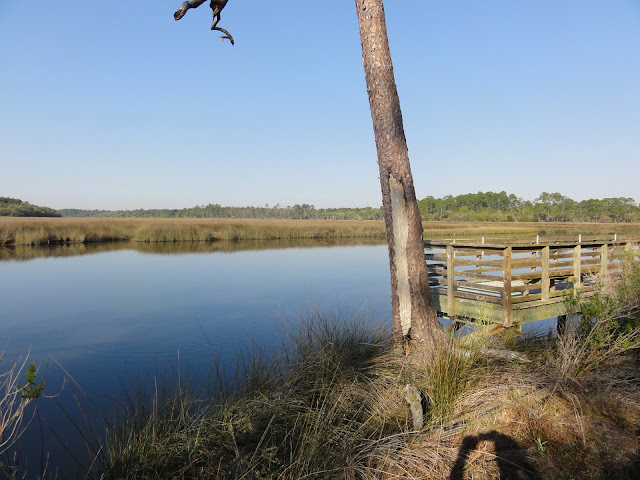
3. Green Ridge State Forest/C&O loop (MD). This is a a~40-45 mile loop that could be done in 3 days and is close to home - the trailhead is less than 2 hours away. Half of the route is along a traditional hiking trail in MD state forest land, and the rest follows the C&O Canal towpath along the Potomac River through rugged and undeveloped mountain terrain. The canal route includes a trip through the Paw Paw tunnel.

4. Foothills Trail (SC). This route follows a route in the high-elevation portion of South Carolina, near the NC border. It's a good 5-7 day route (76 miles), and gets good reviews for waterfalls and solitude. The trail passes through Table Rock State Park, which is said to offer outstanding views.

5. section of the Mountains-to-Sea Trail (NC). This trail is a work-in-progress that will eventually span 1000 miles west-to-east in North Carolina, from Clingmans Dome in the Smokies to the ocean. I think it would be fun to do a week-long section on the mountainous western end of the trail.

6. Florida Trail through Ocala or Appalachicola. The Florida National Scenic Trail starts in Big Cypress National Preserve, just north of the Everglades, and winds it's way through forest remnants along the middle of the state, then turns west to trail the panhandle region. Including alternate and side routes there are around 1000 miles of trail in the system. Some hikers start in Big Cypress (or even in Key West, hiking initially along US route 1) and make their way through connecting routes in Alabama to the AT, then north to Maine. I am not that ambitious, but I would like to do the ~70 mile section in Ocala National Forest, which lies just north of Orlando. This segment has some wilderness character and would be a fun March (spring break) excursion. Another option would be to hike in Appalachacola National Forest, in the panhandle region.

7. Repeat 
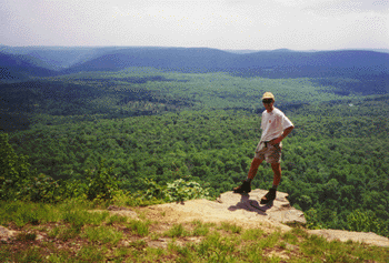
Roan Mnt to I-81 (AT). One of my favorite sections of the AT included the areas around Roan Mountain, the Grayson Highlands, and the Smokies. Given enough time, I would hike from Fontana Dam through the Smokies, over Roan and Rogers again. A one-week trip could start (or end) at Roan Mnt and hike north to Mt. Rogers and beyond. A good end point would be the Settlers Museum, just a few miles from I-81.

8. Repeat Long Mnt. Wayside to Rockfish Gap (AT). We day-hiked this segment over a couple of days, and it included some beautiful views and grassy ridges. I would love to explore them again, especially in May-June or in the fall. A good opportunity for a long weekend or a 5-day trip.

9. Allegheny Trail (WV). This 330-mile trail runs north-south through West Virginia, starting near Pearisburg on the AT and ending north of Canaan Valley - one of our favorite places. It's much less-used than the AT or other eastern trails, and would provide good opportunity for solitude. At this point I am interested in any length trip along this trail, whether a weekend or a full week. A portion of this trail is part of the route for the Great Eastern Trail, a long-distance route that parallels the AT further west. It includes the Sheltowee Trace in Kentucky, the Cumberland Trail in Tennessee, the Pinhoti Trail in Alabama, and the Tuscarora Trail in VA/PA, and in total extends from Alabama to NY.

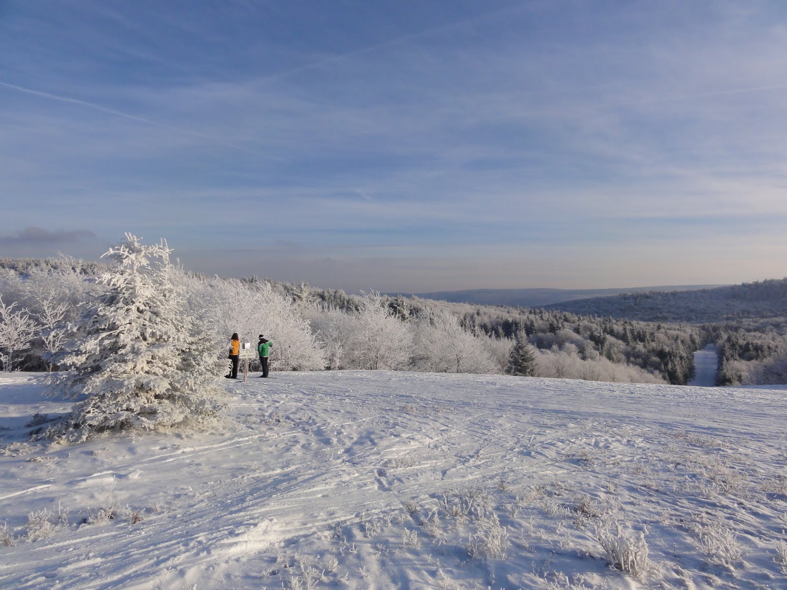
10. Northville-Lake Placid trail. This would be another good week-long excursion, running north-south through the Adirondacks. We have skied a portion of it in the south. There are shelters along the route. It would also be interesting to connect this route to the High Peaks region and summit one or two of the high peaks there at the end of the trip.

Also worth mentioning:

Tuscarora Trail - this ~250 mile trail was envisioned in the 1960's, before the National Trails System act provided federal protection for the AT corridor. Hikers were concerned that the AT route through northern VA and MD would become over-run with development, so they designed this alternate route as a "back-up". It now provides an interesting alternate route, starting near Overall Run Falls in northern Shenandoah and re-joining the AT near Harrisburg, PA. The Potomac Appalachian Trail Club is working in building shelters along the route, with a goal of achieving similar coverage to the AT - shelters every 10 miles or so along the entire route. I have hiked ~60 miles of this trail, mostly at the southern end. It would not be too difficult to use day-hikes and weekend trips to complete the trail without a long-distance backpacking trip.

Pennsylvania trails - there are many little-explored routes in north-central PA, some of which I hiked with the Wilmington Trail Club when I lived in Delaware. There is much more to explore, along the Mid-State Trail, Susqhehannock Trail, and a long section of the 3000+ mile North Country Trail.

Southern Appalachians - with thousands of acres of National Forest land, the southern Appalachian region is covered with trails, for myriad hiking options. I could probably do a long hike here every summer and never leave the region. Other designated trails include the Bartram Trail and the Benton McKaye trail.

Other AT sections - some other favorite portions of the AT that I would like to re-visit include the New Jersey section; Nantahala National Forest (NC); Green Mountains (Vermont - also part of the Long Trail, on my other top 10 list); and most of Maine (given how rugged it is, I can't believe I am including this section - but it truly was beautiful).

Wednesday, May 11, 2011

Top ten "wish" list . . . US backpacking trips

I like to make lists and to dream about travels . . and since last summer I have been considering where I would like to backpack in the future. I have backpacked quite extensively since graduating from college, although the pace has slowed a bit in the past three years. I have hiked the entire Appalachian Trail, and have done two long sections on the Pacific Crest Trail. When I did my first PCT section I was thinking of hiking the entire trail over the course of several years, but now I am not sure - there are lots of other areas to explore, and I am not keen on doing the southern 700 miles in the summer (too hot and dry) or spring break (potential for snow in the higher sections).

So anyway, below is a list of my top 10 backpacking "dream trips". They are not in any particular order.

1. PCT – Crater Lake section. In the ideal world, I would like to hike all of Oregon, and include trekking past Mt. Hood, Jefferson, and the other spectacular Cascade volcanoes. But I figure this would be a good start - Mike and I are tentatively planning to do this section (150-200 miles - depending on how much time we have?) through the Sky Lakes wilderness and Crater Lake in summer 2012.

2. PCT – Tuolomne Meadows to Sierra City. In 2009 I hiked the entire John Muir Trail, which is also the route of the PCT through the high Sierra. This section would continue north from there, through Yosemite and above Lake Tahoe. I am not sure if Sierra City would be the ultimate endpoint, but it seems a logical goal given enough time. It would be great to go all the way to Lassen . . . I think the minimum endpoint goal would be Donner Pass, where I-80 crosses the mountains.

3. PCT – North Cascades. My new plan for the PCT (instead of hiking the entire trail) is to hike representative sections. The Cascades regularly get rave reviews for scenery, wildness, and their remote feeling. I figure this would be a good Washington section to aim for.

4. CDT Weminuche wilderness. This is a remote, high-elevation section of the Continental Divide Trail in southwestern Colorado. I would also like to do several representative sections along this National Scenic Trail, and the Weminuche seems like a highlight, with many miles above treeline.

5. Wonderland Trail. This trail encircles Mount Rainier in Washington. Tatiana have been talking about doing it for several years now . . maybe a 10th anniversary trip? That would be 2013 - not too far off now! It's roughly 90 miles, so it can be done in about a week, perhaps a bit less, depending on how much we are willing to take on . . I would be aiming to do it without a re-supply.

6. CDT – Wind River Range to Yellowstone. This rugged alpine area in Wyoming regularly gets rave reviews. I am not sure how long this segment is because I have not done much research on it, but the notion of a trail starting in this remote paradise, continuing through the Tetons, and into the wolf and grizzly abode of Yellowstone sounds very attractive - and wild.

7. CDT – Bob Marshall wilderness and Glacier. The Bob Marshall Wilderness is the largest wilderness area in the lower 48 states, and is adjacent to Glacier National Park. A trip through the entire region along the CDT, perhaps ending at Waterton Lakes in Canada, would be spectacular. I have already hiked part of the route on a 5-day loop in Glacier, back in 2002.

8. Colorado Trail. This trail winds through the Rocky Mountains in Colorado, with much terrain at very high elevation. A significant portion of it is concurrent with the CDT.

9. Long Trail. This is my first entry for an eastern US trail. I plan to create a second list of east-coast trips, since there are many shorter/less-intense trips I would like to do out here too. I have already hiked ~30% of the Long Trail, in southern Vermont where it's the same as the AT. But it would be fun to hike the entire route, north-south through the Green Mountains from Canada to Massachusetts (or, more likely, the other direction). There are some great alpine zones on the higher peaks in the northern part of Vermont. This would be a good 2-3 week trip, depending on pace.

10. International AT. This route was off my radar until recently, when I watched a promotional video for a new section of the IAT in Newfoundland - which looks beautiful and wild. The rest of the more-established route heads north from Katahdin in Maine and winds through New Brunswick and Quebec.

Runners-up:

Here are a few other places where I would like to hike - with a less well-developed notion of a route or time commitment:

* Ruby Mountains, Nevada - this area in eastern Nevada is said to have the most alpine character of any of the Great Basin ranges. A medium length (30ish miles) linear trail runs along the range.

* Central Idaho - hiking in the Frank Church-River of No Return wilderness just sounds really wild. And I frequently come across beautiful photos of this area. There are reportedly over 2000 miles of trail, so finding a route should not be a problem . . .

* Olympic Peninsula - Washington - photos of Hurricane Ridge, in the center of the peninsula, suggest a very scenic location.

* Canadian Rockies - another scenic area with lots of trail possibilities, stretching from Banff through Jasper to Mount Robson.

Next up . . . a list of top 10 Eastern trips! :)


Wednesday, May 4, 2011

One Day Hike

We participated last weekend in the One Day Hike. We walked the C&O Canal towpath from Georgetown to Harpers Ferry, a distance of 100 Kilometers (62 miles). The hike starts at 3:00am at Thompsons Boathouse in Georgetown, at the end (or beginning, depending on perspective) of the canal - and also the mouth of Rock Creek, where it empties into the Potomac. I finished at 8:30, and Tatiana glided in just before 10:00pm.


The weather was perfect for the hike, and we enjoyed the scenic route in spite of some blister-y feet. The towpath parallels the canal - which was built starting in the 1830s and active less than 100 years - for the entire route. In places, the canal is full of water; in other sections, the water has drained out. In many places the route also featured a good view of the Potomac, which was rushing along at high volume after recent rains. I saw lots of other trail users, notably participants in two bike and/or running relays that were headed the other direction.


I don't think we will be doing this hike again. It's fun, but the logistics (Calista stayed with some friends of ours, who also picked us up) and dealing with the blisters make it a challenge. But I would not rule out doing other long hikes. In the past we have done the Wilmington Trail Club's "End to End" on the Brandywine Trail (~36 miles of forest, field, and old roads in northern Delaware and Chester County PA) and the Hike Across Maryland (~41 miles of the Appalachian Trail from PenMar, on the PA-MD line, to Harpers Ferry. There are several similar organzied events, including one on the Rachel Carson Trail in western PA. One challenge I would like to take on is to hike the entire Presidential Range in the White Mountains in one day.


Here are some other photos that I took on the hike. And some more on the hike's official Facebook page.


Monday, March 28, 2011

Spring break in Florida

We travelled to Florida for spring break this year. Perfect weather for the entire trip - high temps in the 70s and 80s, and low humidity. It was fun to explore new areas and to fast-forward into late spring!

On the way down, we camped at Cliffs of the Neuse state park in North Carolina. Calista had a stomach bug the first night, so we stayed in a hotel near St. Augustine the next night to do laundry and get ourselves back in order. Things went smoothly from there. We drove through Ocala National Forest (our intended place to camp) and visited DeSoto National Memorial. This site commorates the landing of Hernando DeSoto in 1539. He led the first European expedition to extensively explore what is now the Unitied States - less than 50 years after Columbus "discovered" the New World. We heard an NPS ranger discuss the evolution of weapons in native american cultures and among the Europeans, and took a short hike along the water - the park is on a bay south of Tampa/St. Petersburg. That night we camped at Myakka River State Park, which preserves a chunk of undeveloped prairie as well as wetland and river. We explored a "canopy walk" - an elevated tower/bridge combination that allows visitors to view the tree canopy of the forest. I was surprised to learn that "dry prairie" was once a common ecosystem type in Florida; most of it has now been turned into farm or grazing land.

Everglades

One of our major destinations was Everglades National Park. We made a short stop at the visitor center for Big Cypress National Preserve, which protects the bald cypress wetlands north of the "glades". Many tourists had stopped to see alligators in a canal near the visitor center. In 2002, Mike and I had hiked part of the Florida Trail starting from this point. From there, we went to Shark Valley, where we took a short hike and saw some of the famous Everglades wildlife - alligators, anhingas, and other birds. Then it was on to Flamingo, at the southern tip of the park on Florida Bay, where we camped for the night. The next morning, we explored various ecosystems along the main park road, taking short hikes at West Lake (which is lined with mangroves), Mahogany Hammock, and the overlook/tower that provides a view of the vast sawgrass wetlands that defines the Everglades, as well as the famous Anhinga and Gumbo Limbo trails. We returned to the Everglades area a few days later, camping at Long Pine Key for the night. We attended a ranger program, where Calista asked a question and earned a junior ranger badge!


Dry Tortugas

Visiting Dry Tortugas National Park is quite an undertaking. The park is 70 miles west of Key West, and the boat leaves around 8:00am. We stayed in Key West, in order to maximize convenience - and had to settle for a $50 per night campground! It was a somewhat-cramped private campground, but our site did have a nice view of some mangrove-lined water - which might have had an outlet to the ocean. The trip to the island was awesome. Water was very clear and blue. We toured the fort (Fort Jefferson, which was built in the 1830s) on our own, and then took turns snorkeling among coral reefs and playing with Calista on the beach. Calista visited the captain and even got to "drive" the boat for a moment! We had been listening to an audio recording of the Nevada Barr book "Flashback", which takes place on Dry Tortugas - so that added to the experience.

Returning to the mainland, we took another boat trip in Biscayne National Park. The concessioner had botched our reservation for the regular boat, and we ended up on a smaller boat with a group of three people who were in a similar situation. We toured a small island called Boca Chita Key, and zipped over crystal-clear water.

On the way home, we also stopped briefly at Canaveral National Seashore. We hiked up to the top of a large shell midden mound, which afforded a view of the ocean and a lagoon. We camped the final night a Faver-Dykes State Park, a bit south of Jacksonville. The park had a medium-sized, quiet campground in the woods. In the morning we caught views of a scenic river valley in the park (pictured here) before heading north. Temperatures peaked in the low 80s in the morning, but in the Carolinas we hit a cold front and by late afternoon it was in the 40s and raining! We were glad to be driving and not camping, and made it home by 11:00.
This trip included two new NPS sites for me, bringing my total to 278, approximately 71% of all the sites in the system. I am only missing 9 sites in the eastern regions, 4 of which are in the Caribbean. We also spent more time at Biscayne and Canaveral than I had at the past.

Here are the rest of the photos.

Tuesday, February 22, 2011

Lake Placid!

This past weekend we embarked on what has become an annual trip to Lake Placid. We stayed at cozy cabin located near the edge of town, situated on the Jack Rabbit Trail - a ~40 mile skiing route. We skied at Mt. Van Hoevenberg - site of the 1980 Olympic XC ski events - for two days. The groomed trails there are lots of fun. I also skied from the cabin to Van Hoevenberg one morning. On Monday we explored the area around the Adirondack Loj, which is a gateway to the High Peaks area, managed by the Adirondack Mountain Club. I tried out my new snowshoes for the first time, and made it to scenic Marcy Dam and back, round trip ~4.5 miles, in under two hours. We delayed our trip home a bit because the forecast was calling for a winter storm warning in the Albany area, lasting until early afternoon. Traffic was smooth and roads clear until we arrived in Delaware, when to our surprise, snow began to fall. By the time we reached the Susquehanna River, the snow was coming down hard and the highway was getting slick - and with lots of trucks around, we felt a bit nervous. Thankfully, the BW Parkway turned out to be a better route home. Snow diminished dramatically in the last 5 miles before we reached home, although it was enough to delay the opening of school by 2 hours this morning. More photos of our weekend here (look for Calista skiing with her new best friend "Clifford" the dog).

Friday, January 21, 2011

Hiking and travel links

For years, I have had a personal website. Recently I am having some trouble with it - I can't upload new files. I made the mistake of trying to upload an updated main page, which did not work - but now my main page is blank. The rest of the content is there, but there is no easy way to get to it.

At least as a temporary fix, I am providing links to some of my content below. I also have created some permanent links on the blog, to the right.

Our photos on Picasa and Flickr

Appalachian Trail backpacking journal - with separate pages for each major trip/segment, lost of links and photos, plus Google Earth versions!

My trip journals - covering backpacking, camping, and other trips since the mid-90s

John Muir trail trip report - with a Google map and Google earth versions

Pacific Crest Trail trip in 2010

Winter wonderland

Every year we make several weekend escapes to go cross country skiing. This year we managed some skiing in Michigan on several days while we were there, although conditions deteriorated before we left. But last weekend, we experienced the joys of true winter again in Canaan Valley. Canaan, which usually experienced the best snow cover reachable by weekend trip for those of us in the DC area, is blessed with a quirky cross country ski resort called Whitegrass. This resort has miles of groomed trails traversing nearly 1000 feet of elevation rise, with access to many more miles of backcountry trails.


This year we stayed in a rental house with some friends, and enjoyed swishing through fresh snow for three days. On the second day, I traded off with Tatiana and did a long ski in the afternoon, which provided me with a first-ever opportunity to reach the overlook at Bald Knob while it was bathed in late afternoon sunlight. Conditions were calm, and the snow and ice on the trees was truly beautiful. I also found, for the first time, the connection between the backcountry Cabin Mountain and National Nordic trails. I have more photos here (not many "people" shots this time . . I took all my pics while out on the trails. Still need to coordinate photos from Tatiana!).


We will return to Canaan at the end of February, and also plan to ski at Lake Placid in a few weeks. Thanks to God for snow!!


Sunday, January 9, 2011

Christmas


We spent the first part of our Christmas vacation in Hampstead, hanging out with Tyson, Sarah, and Tatiana's parents. The earlier part of the month had been very hectic, with Tatiana finishing multiple projects relating to her first semester of the PhD program, while I graded exams.

From Maryland, we made the 12-hour drive to western Michigan on Dec 27th. No problems on the trip, since the major snowstorm coming in that day stayed well to the east, along the coast. In Michigan we were able to ski several times before the weather warmed up, including a nice all-day outing at Big M. Mike and Susanna were around for several days too. We were able to visit other family too, including Aunt Helen, and Uncle Gord and Aunt Saramae. On the way home, we took an alternate route via I-80 in western PA and Us 322 to Harrisburg - a nice change from the usual turnpike.

Now it's on to other winter challenges, including the start of a new semester (for me) and prepping a new class for the UD semester that starts in a couple of weeks (for Tatiana). And for the fun stuff - we have three weekend ski trips to WV and NY planned during the next two months. Yeah for snow!!