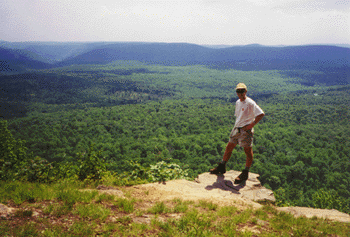
On Saturday, April 25th we hiked from Washington DC to Harpers Ferry. I can't believe I am actually writing that, but yes, we did manage to hike that far! It was a crazy event. Calista went with Tatiana's parents and her Aunt Irene to Chincoteague for the weekend, so we were free to make the attempt. We got up at 1:00 on Saturday morning and drove to the metro, taking the train down to Georgetown. More than 100 other people were milling about at Thompson's Boathouse, getting ready for the hike. We started the hike at 3:00, after signing in and getting instructions. The first 12 miles were in the dark, strolling between old warehouses that have been converted to upscale apartments and shops in Georgetown, and then out to the tree-lined, crushed gravel path that borders the C&O Canal. I used my headlamp sporadically, sometimes relying on streetlights from nearby Canal Road. The first water break was at Old Angler's Inn, and after a short break I was soon passing Great Falls. The first food stop finally appeared at mile 22, and by mile 30 the sun was beating down. The heat index eventually topped 90, an unusually warm day for April.
Somewhere around mile 25 I started seeing runners with numbers heading the other direction. At the next rest stop I learned that they were part of a 200 mile relay event, with 10-12 person teams each running several 5-8 mile legs along a route starting in Gettysburg and ending in DC. They were raising money for something.
By the mid-point I was dealing with some pretty serious blisters, but I was determined to press on. I maintained close to 4 mph for the first half of the hike, but slowed quite a bit afterward. The heat took its toll on the other hikers too, and many dropped out before the finish, with less than 50% reaching the goal. I felt like I was in slow motion after my last break at Brunswick, less than 10 miles from the end. Darkness fell around the time the canal towpath intersected with the Appalachian Trail, coming from the north. Tatiana and our friend Nathaniel met me at the base of the hill in Harper's Ferry, and we slowly made our way up the long route past the ATC headquarters, the NPS facility, and into the adjacent town of Bolivar. Upon finishing, I suddenly felt overwhelmed with exhaustion and had to lay down for a few minutes. Eventually we made our way to a nearby campground, where we stayed with Christal and Nathaniel in a small cabin for the night.
I
uploaded some pictures. Also in the album are a few shots of Philadelphia, where we spent the weekend May 2-3. Tatiana had a conference for the American Association of Museums. I biked on Saturday from Center City Philadelphia to Valley Forge, along the Schuylkill River. The route is mostly a paved trail, except for a few miles following a canal towpath in the Manyunk section of Philly. Distance to Valley Forge is ~20 miles, but I actually did another 5 to Phoenixville, where the trail currently ends, before turning around. There are plans to extend the trail to Port Clinton, where it would intersect the Appalachian Trail.
There are also pictures of the One Day Hike
here and
here.
 Last weekend (May 9) we visited Thompson Wildlife Management Area, which is in the Appalachians (and bisected by the AT) just south of Sky Meadows State Park - about midway between Harper's Ferry and Shenandoah. This area is known for a profusion of trilliums and other spring wildlflowers. We parked quite close to the AT, and did a short (~2 mile) loop hike. We stopped at a trail shelter at Manassas Gap, and Calista enjoyed stomping around in the shelter. We decided to give her the trail name Itty Bit, which is also the name of her favorite stuffed animal (a bunny). We signed her name, along with ours, in the trail register at the shelter. We were also startled to find a couple of rather large black rat snakes in the rafters of the shelter! Calista was not bothered by the snakes (although I don't know how well she saw them) but she did freak a bit about the large bumblebees near the picnic table.

